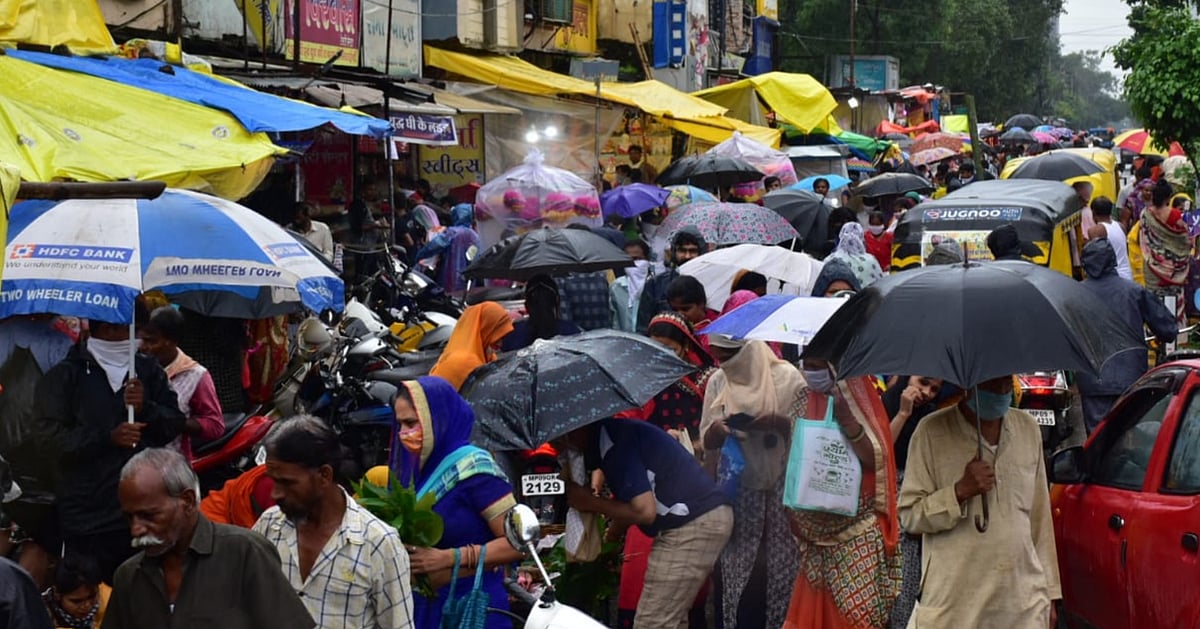
Indore: Bringing much-needed relief to a parched city crying for showers far past the normal entry date of the South-West Monsoon, rainfall—which began on Saturday night—continued to lash the city intermittently till Sunday evening. About 41.3 mm (1.66 inches) of rainfall were recorded from 8.30 pm on Saturday to 5.30 pm on Sunday by the meteorological centre of the Regional Meteorological Department at the city airport.
Similarly, 24.5 mm—about 1 inch—rainfall was recorded by the monitoring centre of the Madhya Pradesh Pollution Control Board at Regal Square. With this, the rainfall measure has crossed 8.93 inches.
According to officials of the Regional Meteorological Department, the city’s current total rainfall (8.93 inch) is about 24 per cent less than last year’s rainfall. However, similar conditions will prevail for one more day and it may cross the 10-inch mark.
Night temp remains normal
Under the influence of these conditions, the western part of the state will continue to witness moderate-to-heavy rainfall till July 26
Continuous rain also kept the night temperature within the normal range. The intensity of rain increased on Saturday night
However, the shower power was heavy in the western part of the city, while the eastern part received comparatively less rain
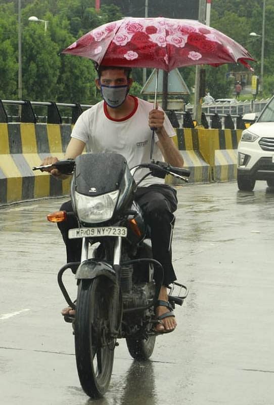
A balancing act. | FPJ

25°Celsius (4°Celsius below normal): Maximum temperature recorded on Sunday
22.6°Celsius (normal): Night temperature recorded on Sunday
95 per cent: Humidity recorded on Sunday
‘Low-pressure area’
"A low-pressure area lies over north-east Madhya Pradesh and its neighbourhood. The associated cyclonic circulation extends up to the mid-tropospheric levels. It’s likely to move slowly west-north-westwards until Monday. The monsoon trough at mean sea level now passes through Bikaner, Ajmer, Jhansi and the centre of the low-pressure area over north-east Madhya Pradesh and its neighbourhood, Daltonganj, Berhampore and, thence, eastwards on to Manipur," meteorological department officials said in the daily weather bulletin.
