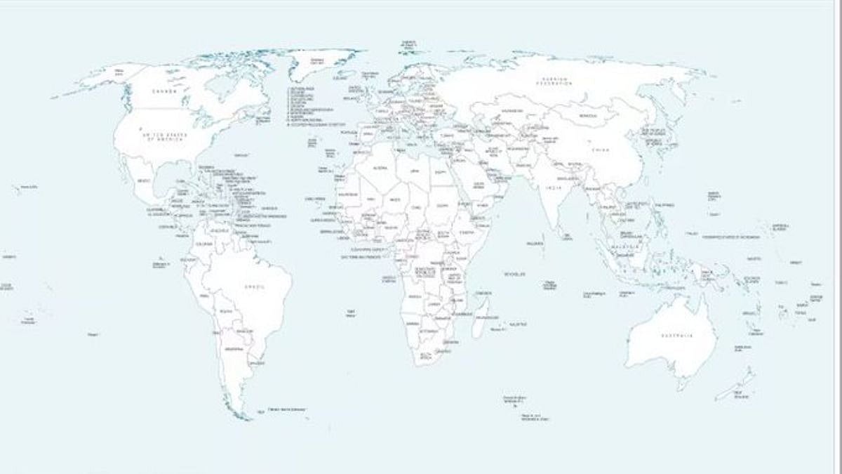
A recently released United Nations world map has sparked fresh discussion in India because of how it portrays Arunachal Pradesh and Aksai Chin. The map, issued amid deliberations on the UN General Assembly’s ‘Correct the Map’ resolution, places the two areas between competing Indian and Chinese territorial claims.
The map was unveiled on July 1 during discussions linked to the UNGA resolution. In its depiction of Arunachal Pradesh, the map does not show a border between the northeastern state and Nagaland. Instead, it presents Arunachal Pradesh as a separate region, shown as sharing boundaries with Assam and China.
Aksai Chin has similarly been represented as a distinct region. The map places India along its western side and China along its eastern side. The UN has not provided an explanation for these particular cartographic changes.
What The UN Map Says About The LoC In Jammu & Kashmir
The document also marks the Line of Control (LoC) in Jammu and Kashmir with a dotted line. In its accompanying notes, the UN clarifies that the "dotted line represents approximately the LoC in Jammu and Kashmir agreed upon by India and Pakistan."
"The final status of Jammu and Kashmir has not yet been agreed upon by the parties," it said.
What Is The UN’s 'Correct The Map' Resolution?
The UN General Assembly last week approved an African Union-supported resolution titled "Correct the Map". The measure seeks to encourage more accurate and balanced representations of different parts of the world on maps, with particular emphasis on correcting the cartographic portrayal of Africa.
Although the resolution does not carry legal force, it is expected to influence how international and multilateral organisations standardise their maps in the future.

India’s Position On Territorial Maps
Togo introduced the resolution on behalf of the African Group. India supported the measure, with the Ministry of External Affairs clarifying that New Delhi’s vote was based on the "underlying principle of promoting equal–area cartographic representation."
"We also highlighted that the resolution does not constitute endorsement of any specific map, projection, or depiction of national boundaries," the Ministry said.
"India's sovereign territory, including the Union Territories of Jammu and Kashmir and Ladakh, must be depicted in accordance with India's official map. Any inaccurate or misleading depiction is unacceptable. Our position on India's sovereignty and territorial integrity is clear, consistent, and non-negotiable," it added.

India Yet To Respond Specifically To New UN Map
The Indian government has not yet issued a specific response to the way the UN map depicts Arunachal Pradesh and Aksai Chin using competing Indian and Chinese claim lines.
India has repeatedly asserted that the entire Union Territory of Jammu and Kashmir and Ladakh, including Aksai Chin, "has been, is and will always be an integral and inalienable part of India." New Delhi has also consistently stated that Arunachal Pradesh forms an integral part of Indian territory.

