Bhopal (Madhya Pradesh): A strong weather system is expected to become active in Madhya Pradesh from March 29, bringing thunderstorms, rain, and strong winds across the state for about three days.
Weather expected on Saturday
On March 28, however, the weather will remain hot across the state. Places like Narmadapuram have already recorded temperatures around 40°C, with heatwave-like conditions.
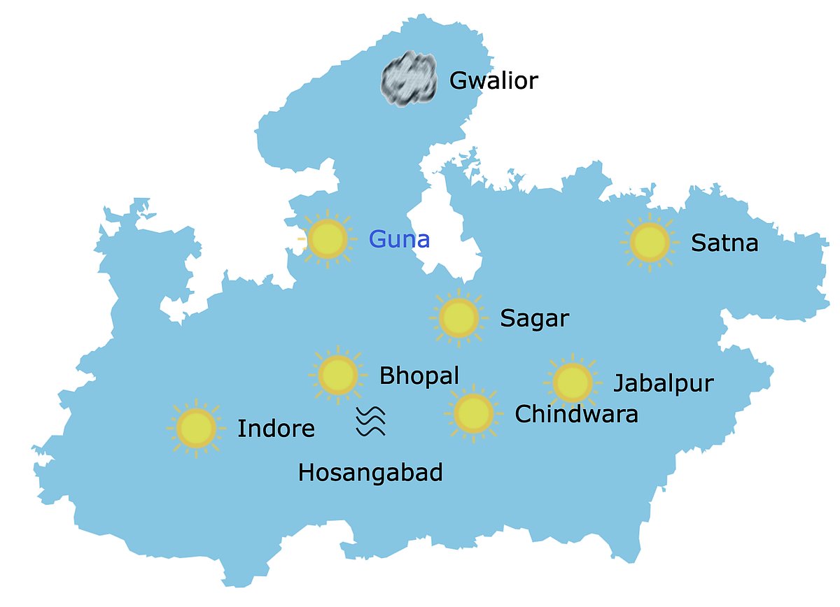
Weather in Madhya Pradesh at 10: 30 Am | IMD Bhopal
What do meteorologists say?
According to the Meteorological Department, around 40 districts - including Bhopal, Ujjain, Gwalior, and Jabalpur - are likely to experience rain and gusty winds. Wind speeds may reach 40 to 50 km/h during this period.
Cloud cover is expected in some districts, and light drizzle may occur in isolated areas, but overall, the heat will dominate on this day.
A similar weather change was seen on Friday due to cyclonic circulation and a trough, bringing clouds to divisions like Gwalior, Chambal, Rewa, Sagar, and Jabalpur.
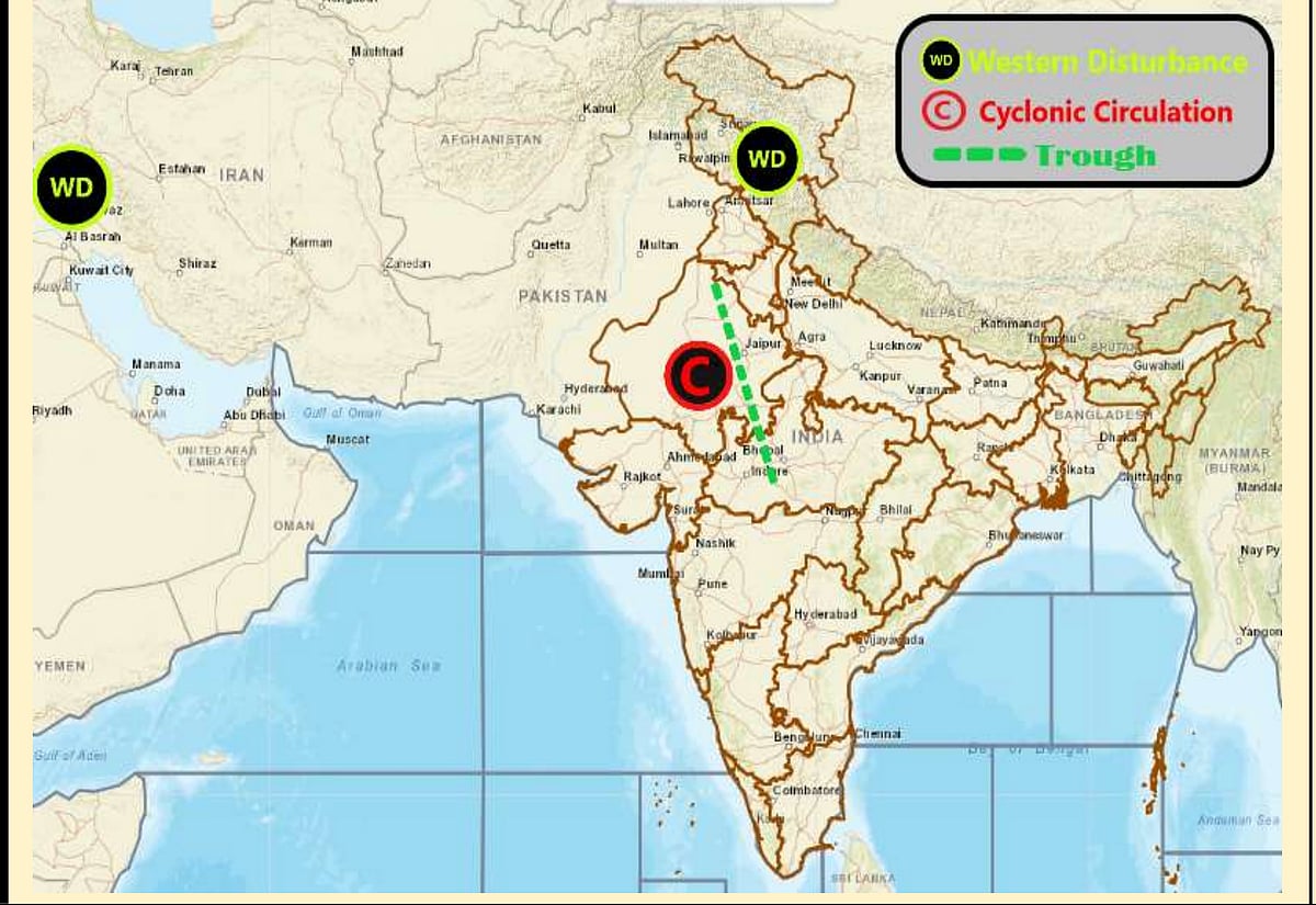
Weather systems affecting Madhya Pradesh at present | IMD Bhopal

Weather in upcoming days
Sunday: This system is expected to weaken by Saturday, leading to a rise in temperature before the new system becomes active on March 29.
Rain alerts have been issued mainly for northern districts such as: Gwalior, Sheopur, Morena, Bhind, Datia, Niwari, Tikamgarh, Shivpuri, Guna, Ashoknagar, Neemuch, and Mandsaur.
Monday: The impact of the new system will be strongest on March 30 and 31, with widespread rainfall expected across several divisions including Bhopal, Indore, Ujjain, Gwalior, Chambal, and Sagar.