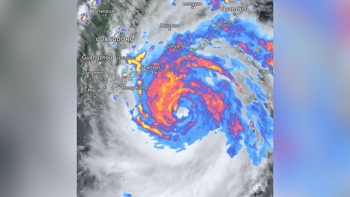
Beijing, July 26: China's national observatory has issued a red alert — the highest level in the country's typhoon warning system — as Typhoon Noul approaches its coast.
Typhoon Noul, the 12th typhoon of the year, is forecast to make landfall along the coast of south China's Guangdong Province, according to the alert issued by the National Meteorological Centre late Saturday night.
The typhoon's centre was about 100 km offshore southeast of Huidong County in Huizhou City, Guangdong, late last night, with maximum winds near the centre reaching Force 14, the NMC said.
Emergency Measures Activated
The NMC forecast that Typhoon Noul will move northwestward at around 20 km per hour while continuing to strengthen.
After making landfall, it is expected to shift to a north-northwestward course and gradually weaken, state-run Xinhua news agency reported.
Earlier on Saturday, the State Flood Control and Drought Relief Headquarters raised its emergency response for flood and typhoon control in Guangdong Province to Level III, while activating a Level IV flood emergency response for Jiangxi and Hunan provinces.
China has a four-tier, colour-coded weather warning system for typhoons, with red representing the most severe warning, followed by orange, yellow and blue.
The regions affected include Fujian, Jiangxi, Henan, Hubei, Hunan, Guangdong and Guangxi, covering large parts of eastern, central and southern China.

Hong Kong Prepares For Storm
Met officials in Hong Kong on Saturday initiated emergency measures as Typhoon Noul approached. More than 410 flights and 150 high-speed train services were cancelled, while the Home Affairs Department had opened 28 shelters in anticipation of the approaching storm.
(Except for the headline, this article has not been edited by FPJ's editorial team and is auto-generated from an agency feed.)

