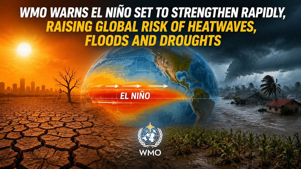
Geneva, July 3, 2026: El Niño conditions have developed in the tropical Pacific and are expected to strengthen rapidly over the next few months, increasing the chances of heatwaves, droughts, heavy rainfall and other extreme weather events across many parts of the world, according to the World Meteorological Organization (WMO).
The UN weather agency said its latest Global Seasonal Climate Update points to the rapid development of a strong El Niño event between July and September 2026.
Forecasts from leading global climate centres show a significant warming of ocean temperatures across the central and eastern equatorial Pacific, with seasonal average sea-surface temperature anomalies likely to exceed 2°C in key monitoring regions.
High Confidence In Forecasts
According to the WMO, forecast models show remarkable agreement, giving scientists high confidence that El Niño will continue to strengthen during the Northern Hemisphere autumn. The equatorial Atlantic is also expected to remain warmer than average, adding to the broader climate picture.
The seasonal update complements the WMO's El Niño/La Niña Update issued on June 2 by considering multiple climate drivers, including the Indian Ocean Dipole and Atlantic Ocean conditions, instead of focusing only on El Niño.
WMO Secretary-General Celeste Saulo said El Niño conditions are already underway and are strengthening as anticipated by the agency's forecasts. She said this will increase the likelihood of drought, heavy rainfall, heatwaves on land and marine heatwaves in many regions.
Saulo added that the WMO community has launched an unprecedented mobilisation to coordinate activities across the United Nations, regional organisations, governments, humanitarian agencies and climate-sensitive sectors such as agriculture and health.
She stressed that advanced seasonal forecasts and early warning systems are essential to save lives and reduce the impact on economies and communities.
A Global Climate Driver
El Niño and La Niña are opposite phases of the El Niño-Southern Oscillation (ENSO), one of the world's strongest drivers of year-to-year climate variability. El Niño is characterised by above-average sea-surface temperatures in the central and eastern equatorial Pacific Ocean.
The phenomenon usually develops every two to seven years, lasts for nine to 12 months and generally begins between March and June. It typically reaches peak intensity between November and February, while its strongest influence on global temperatures is often felt in the following year.
The WMO noted that the impacts of every El Niño event differ depending on its strength, duration, time of development and interaction with other climate patterns such as the Indian Ocean Dipole. It also cautioned that not all regions experience the same effects and that extreme weather can occur even during neutral ENSO conditions.
The organisation classifies ENSO events as weak, moderate, strong or very strong. It clarified that the term "super El Niño" is not part of its official operational classification and is therefore not used in WMO products.
What The Outlook Shows
The seasonal outlook indicates an overwhelming probability of above-average temperatures across most land areas between 60°S and 60°N, covering nearly all populated regions outside the polar areas.
Over the oceans, there is more than an 80% chance of above-normal sea-surface temperatures in the equatorial Pacific east of the International Date Line. Above-normal temperatures are also expected across the Indian Ocean and the tropical Atlantic, while a horseshoe-shaped area of below- to near-normal temperatures is forecast over the North Atlantic.
The July-September 2026 rainfall outlook also reflects the influence of a strengthening El Niño. Above-normal rainfall is expected across the central and eastern equatorial Pacific, while below-normal rainfall is more likely over parts of the tropical Indian Ocean, the Indian subcontinent and much of Australia.
Across equatorial Africa, wetter-than-normal conditions are forecast for areas bordering the northern Gulf of Guinea, while the Greater Horn of Africa is expected to receive below-normal rainfall. Below-normal rainfall is also forecast for parts of Central America, the Caribbean and north-western South America. In contrast, parts of the south-western United States are likely to experience wetter-than-average conditions.
Europe is expected to see a north-south divide, with southern Europe more likely to receive above-normal rainfall and northern Europe expected to be drier than usual. However, the WMO said forecast confidence for Europe remains lower than for many other regions.
Preparing For The Impacts
The WMO said it is expanding its climate information services and strengthening coordination to help countries prepare for the expected impacts of El Niño. Regular briefings are being held across the United Nations system and with humanitarian partners to support preparedness and risk management.
A WMO Coordination Mechanism Seasonal Climate Outlook briefing held on June 24, 2026, included regional forecasts such as the 2026 West African and Sahel rainy season outlook from the AGRHYMET Regional Climate Centre.
The agency is also planning webinars and technical exchanges to improve regional coordination, communication and preparedness as the El Niño event continues to develop.
Also Watch:

The latest forecasts underline how closely governments and disaster management agencies will need to monitor seasonal weather patterns over the coming months.
While El Niño is a naturally occurring climate phenomenon, timely forecasts and early warning systems will play a crucial role in reducing risks to lives, livelihoods and climate-sensitive sectors across the world.
To get details on exclusive and budget-friendly property deals in Mumbai & surrounding regions, do visit: https://budgetproperties.in/