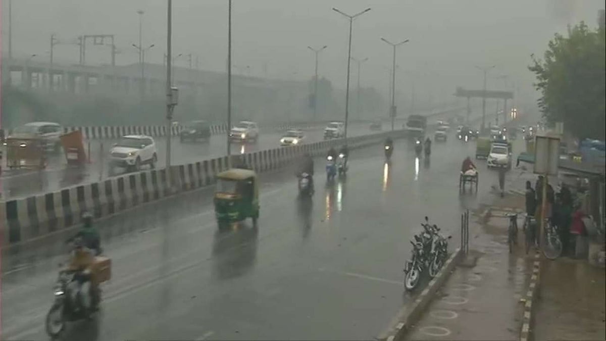
New Delhi, July 2: After days of heatwave and humidity, monsoon finally arrived in the national capital on Thursday, five days after its normal onset date.
Parts of Delhi received rainfall in the morning and witnessed cloudy skies, while temperatures dropped.
Experts said the city will experience monsoon-like rains by July 5 after the seasonal trough moves northwards again, resulting in another spell of rain over Delhi and other parts of northwest India.
The weather office has issued a yellow alert for Friday, predicting a generally cloudy sky with moderate rain, while the minimum and maximum temperatures are expected to hover at 22 and 32 degrees Celsius, respectively.
First July Onset Since 2021
This also marked the first July onset of monsoon in Delhi since 2021, when rains arrived in the city on July 13.
The India Meteorological Department (IMD) declared the onset of monsoon over the region after favourable atmospheric conditions developed.
Last year, the monsoon arrived on June 29. The earliest monsoon onset in the city in the last 125 years was recorded on June 15, 2008, while the most delayed arrival was on July 26, 1987.
In 2020, the rain arrived on June 25, a day before it covered the entire country. In 2021, monsoon reached Delhi and covered the whole country as well on the same day: July 13.
Monsoon arrived in Delhi on June 30 in 2022, on June 25 in 2023, and on June 28 in 2024, while it covered the whole country on July 2 in all three years, according to data accessed by PTI.
Last year, it reached Delhi and completed its advance over the entire country on June 29.
Weather Systems Driving Rain
According to Mahesh Palawat of Skymet Weather, the recent light to moderate rainfall over parts of north India, including Delhi, was triggered by a low-pressure area over Odisha and an associated cyclonic circulation extending across parts of Madhya Pradesh and south Sindh.
"The monsoon generally advances along the seasonal trough, which currently stretches from Punjab to the Bay of Bengal," Palawat said.
He said the seasonal trough is expected to shift southwards towards central India from Friday, leading to enhanced rainfall over central India, while rainfall activity over the Indo-Gangetic plains, including Delhi, Punjab and Haryana, may temporarily decline.
Temperature Records Fall
According to the IMD, Delhi’s base weather monitoring station in Safdarjung recorded a maximum temperature of 33 degrees Celsius on Thursday, 4.4 degrees below normal. The minimum temperature was recorded at 22.8 degrees Celsius, 5.1 degrees below normal.
The city also recorded its lowest minimum temperature since July 21, 2021, when it stood at 22.4 degrees Celsius at the base station.
Palam recorded a maximum temperature of 33 degrees Celsius, 4.8 degrees below normal, and a minimum of 21.2 degrees Celsius, 6.6 degrees below normal.
Lodi Road recorded a maximum temperature of 33 degrees Celsius, 3 degrees below normal, and a minimum temperature of 23.6 degrees Celsius, 3.4 degrees below normal.
The Ridge station recorded a maximum temperature of 33.8 degrees Celsius, 2.9 degrees below normal, while the minimum settled at 21 degrees Celsius, 4.5 degrees below normal.
Ayanagar recorded a maximum temperature of 32.4 degrees Celsius, 5.7 degrees below normal, and a minimum of 22.6 degrees Celsius, 4.2 degrees below normal.

Rainfall Data Recorded
Safdarjung received 4.6 mm of cumulative rainfall till 8.30 am on Thursday, with no rainfall recorded between 8.30 am and 5.30 pm.
Palam received 1.9 mm of rain and Ayanagar received 5 mm till 8.30 am and recorded trace rainfall thereafter.
Lodi Road received 4.1 mm and Ridge recorded 3 mm till 8.30 am, and no rainfall during the day.
Pre-Monsoon Pattern Explained
Explaining the delayed onset of monsoon, Palawat said the humid easterly winds from the Bay of Bengal, which are essential for sustained monsoon rainfall, had not reached Delhi earlier.
The onset of monsoon comes after a warmer-than-usual pre-monsoon season in the capital. As the season drew to a close, Delhi recorded its warmest summer nights in four years, with the average minimum temperature during the March–June pre-monsoon period climbing to 22.9 degrees Celsius, the highest seasonal average since 2022, according to IMD data accessed by PTI.
Also Watch:
The pre-monsoon season was also marked by early showers, persistently hot days, brief but intense heatwave spells and the delayed onset of the monsoon.
The average minimum temperature stood at 22.9 degrees Celsius, compared with 21.2 degrees Celsius in 2021, 23.3 degrees Celsius in 2022, 20.9 degrees Celsius in 2023, 22.8 degrees Celsius in 2024 and 22.5 degrees Celsius in 2025, making it the highest seasonal average since 2022.
The average maximum temperature during the March–June pre-monsoon period stood at 37 degrees Celsius, compared with 36.5 degrees Celsius in 2021, 38.4 degrees Celsius in 2022, 35 degrees Celsius in 2023, 37.6 degrees Celsius in 2024 and 36.6 degrees Celsius in 2025, making it the second-highest seasonal average in the last six years after 2024.
(Except for the headline, this article has not been edited by FPJ's editorial team and is auto-generated from an agency feed.)