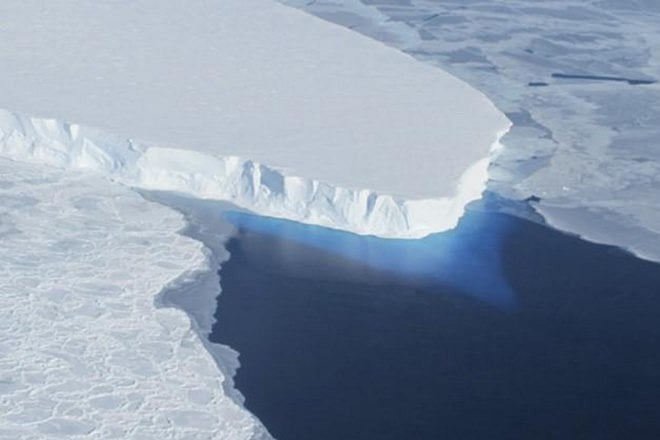
New York: Using a robotic submarine, researchers have taken the first-ever images of the Antarctic Thwaites glacier's foundations, a step towards better monitoring of the ice sheet which is notorious for its contributions to sea-level rise. A particular area of concern, visited by the robotic submarine, named Icefin, is a boundary called the grounding line between where the glacier rests on the ocean bed, and where it floats over water. The scientists noted that this grounding line is important to the stability of Thwaites Glacier's footing since the farther it recedes, the faster the ice can flow into the sea, pushing up sea-level.
