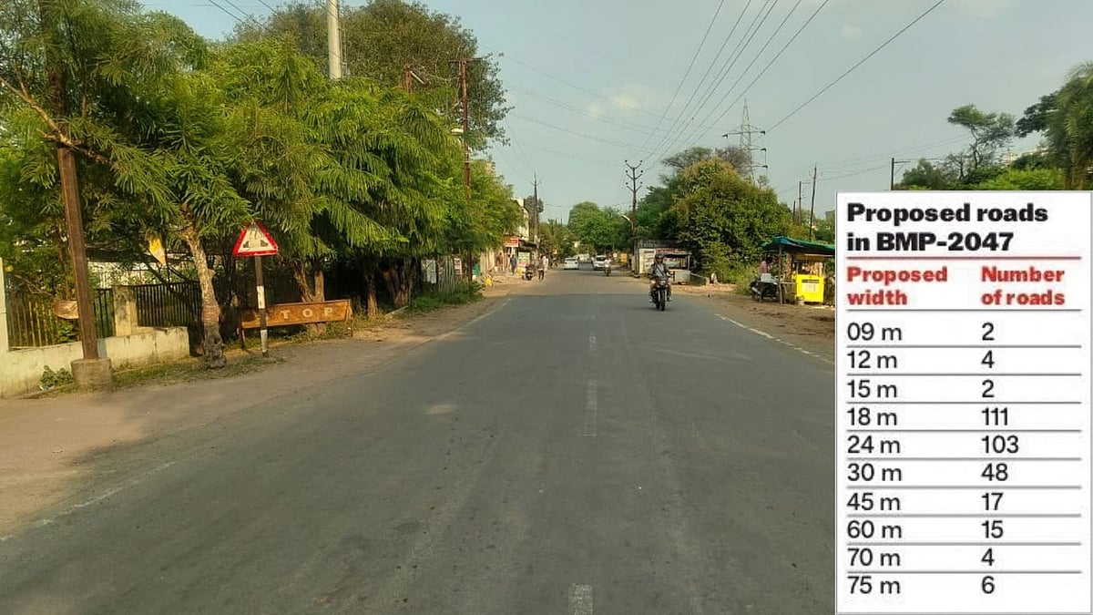
Bhopal Master Plan road network: The proposed 791-km road network under Bhopal’s Draft Master Plan 2047 could have a significant environmental impact if the scale of tree cutting recorded in a recent major road project is used as a benchmark, environmental and urban experts said. The draft envisages an overall road network of about 791.42 km, comprising corridors of different widths, including 18 m, 24 m, 30 m, 45 m and 60 m. The proposal also includes roads of 9 m, 12 m, 15 m, 70 m and 75 m widths. Among the pro-posed corridors, 18 m and 24 m roads are the dominant categories, with 111 and 103 road-width annotations respectively.
Dr Krishna Kumar Dhote, professor and head of the Department of Architecture and Planning at Maulana Azad National Institute of Technology (MANIT), Bhopal, pointed out a discrepancy in the proposed road markings. He said several stretches that were already marked as proposed 10 m or 15 m roads appear to have overlapping road markings, which, when considered together, could result in a substantially wider corridor of more than 24 m. Residents have alleged that these overlaps are in-tended to make the establishments valid for commercial use.
Nearly 2.9 lakh trees: A benchmark-based projection
A recent NHAI road project provides a reference point for estimating the potential scale of tree loss. Around 6,000 trees were reportedly cut for a 16.44-km, 10-lane road, translating to roughly 365 trees per kilometre.
Environmentalist Dr Subhash C Pandey said that if this rate were applied purely as a benchmark to the proposed 791.42-km road network, the indicative number would come to around 2.89 lakh trees. Environmental activist Nitin Saxena said that, at a compensation rate of Rs 1,450 per tree, the corresponding indicative compensation would be approximately Rs 42 crore. However, experts stressed that this is not an estimate of the actual number of trees that would be cut in Bhopal.
Dr Jagdish Singh of MANIT, Bhopal, said the actual impact would depend on the final road alignments, the existing vegetation along individual stretches, land acquisition require-ments and the extent of widening required.

