Mumbai’s 27-Km Inner Ring Road Around Nariman Point To Create New Traffic Corridor
Mumbai’s planned ring-road network will begin with a 27-km inner loop connecting Nariman Point through the Coastal Road, Sewri-Worli Elevated Connector, Eastern Freeway and Orange Gate-Marine Drive link. The loop will become operational after missing connections are completed. The wider network aims to create alternative routes and reduce dependence on congested city corridors.

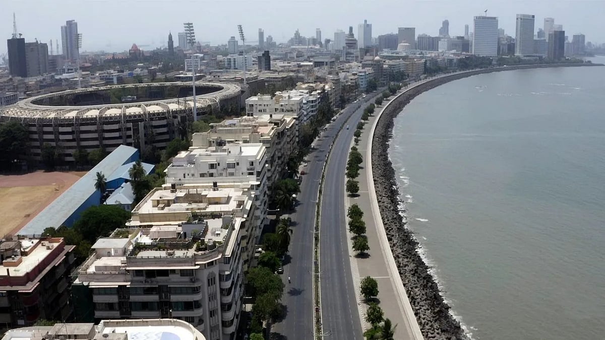
Mumbai’s 27-Km Inner Ring Road Around Nariman Point To Create New Traffic Corridor | X
Mumbai’s planned ring-road network, beginning with a 27-km inner loop around Nariman Point, is set to take shape progressively as several key infrastructure projects connecting the city’s eastern and western corridors are completed.
Nariman Point Loop Design
The smallest of the proposed rings, measuring approximately 27 km, is designed to connect Nariman Point through the Mumbai Coastal Road Project, the Sewri-Worli Elevated Connector, the Eastern Freeway and the Orange Gate-Marine Drive connection, before returning towards Nariman Point.
While the Coastal Road and Eastern Freeway are already operational, the Sewri-Worli Elevated Connector and Orange Gate-Marine Drive connection are under construction. Completion of these missing links will be crucial to making the first ring function as a continuous alternative route.
Multiple Rings Planned Across MMR
The 27-km loop is the first of a series of progressively larger rings planned across the Mumbai Metropolitan Region. The subsequent rings measure 34 km, 67 km, 98.4 km, 119.62 km, 185.55 km, 197km, 110km and 273.5 km, with each incorporating a wider network of major roads, sea links, tunnels and elevated corridors.
The larger rings will bring together infrastructure such as the Bandra-Worli Sea Link, Western Express Highway, Santacruz-Chembur Link Road, Jogeshwari-Vikhroli Link Road (JVLR), Eastern Freeway Extension, Northern Coastal Road, Dahisar-Bhayandar connectivity, Uttan-Virar Sea Link and Atal Setu.
The objective is to provide motorists with multiple alternatives to travel between eastern and western suburbs, north and south Mumbai, Thane, Mira-Bhayandar and the rapidly developing areas across the harbour, reducing dependence on a handful of heavily congested north-south corridors.
Reducing Mumbai’s Traffic Pressure
The ring-road approach was first enunciated by Dr Sanjay Mukherjee, Commissioner, MMRDA, in 2024, as a way of changing the geometry of Mumbai’s road network.
Unlike a conventional road development strategy that focuses on connecting two individual locations, the ring concept seeks to create east-west connections and orbital movement. This would allow motorists to bypass congested central stretches by moving around them through interconnected corridors.
One project, multiple journeys
Under the proposed network, individual infrastructure projects are not viewed in isolation. A sea link, tunnel or elevated road could form part of several longer journeys once connected with adjoining infrastructure.
For instance, a motorist could enter the network through one corridor and combine multiple links to travel across the metropolitan region without having to rely on traditional routes passing through congested areas.
ALSO READ
This makes the completion of each missing link important not only for the direct connectivity it provides but also for the wider network.
The ongoing and recently completed projects are therefore gradually filling the gaps required to close the proposed loops and create a more seamless road network.
A single east-west connector, once completed, could link two established north-south corridors while simultaneously becoming a component of a much larger orbital route. In this way, the utility of existing infrastructure could increase substantially as new links are added.
The 27-km Nariman Point loop is consequently the first building block of a much larger network, with its full potential dependent on the timely completion and integration of the projects that currently remain under construction.
To get details on exclusive and budget-friendly property deals in Mumbai & surrounding regions, do visit: https://budgetproperties.in/
RECENT STORIES
-
-
-
-
-