WATCH: Guatemala Declares Orange Alert As Volcán de Fuego Erupts Lava And Ash Trigger Evacuations
Guatemala has declared an Orange Alert after Volcán de Fuego entered a powerful eruptive phase, sending lava, ash and pyroclastic flows down its slopes. Authorities evacuated vulnerable communities, closed roads, suspended classes and restricted access to the volcano. Officials warned the intense activity could continue for 24 to 72 hours as monitoring remains underway.

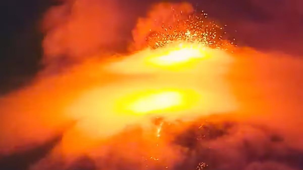
Guatemala has declared an Orange Alert, the country's second-highest emergency level, after Volcán de Fuego (Volcano of Fire) entered a powerful eruptive phase, triggering evacuations, road closures and widespread emergency measures in several regions. According to Global Nation, the volcano, located around 35 kilometres southwest of Guatemala City, has shown a significant increase in activity.
Eruption Intensifies Into Paroxysmal Phase
According to The Watchers, the latest eruptive episode began at around 8:30 am local time on August 3, citing Guatemala's National Institute of Seismology, Volcanology, Meteorology and Hydrology (INSIVUMEH).
The eruption intensified through the day before reaching a paroxysmal, or peak-intensity, phase late on August 3. During this stage, lava fountains shot approximately 200 to 300 metres above the crater, while ash and gas columns rose between 5,000 and 6,000 metres, with some estimates suggesting the plume may have exceeded 7,000 metres.
Ash from the eruption spread as far as 130 kilometres westward toward Guatemala's Pacific coast, affecting communities across the departments of Chimaltenango, Escuintla and Sacatepéquez, including San Pedro Yepocapa, The Watchers reported.
Dangerous Pyroclastic Flows Race Down Volcano Slopes
The most immediate threat came from pyroclastic density currents fast-moving clouds of scorching gas, volcanic ash and rock fragments.
According to The Watchers, these flows travelled between 5 and 7 kilometres down several ravines, including Seca, Ceniza, Taniluyá, Las Lajas and Honda, on the volcano's southwestern, southern and southeastern slopes.
Evacuations Ordered As Emergency Response Intensifies
According to Inform NNY, Guatemala's National Coordinator for Disaster Reduction (SE-CONRED) declared an Institutional Orange Alert and ordered preventive evacuations from vulnerable communities, including El Porvenir and Las Lajitas.
Initial reports indicate that around 50 families, or nearly 250 people, were evacuated to emergency shelters established in areas such as Escuintla and Alotenango. Authorities also urged residents to leave immediately if conditions became unsafe.
Roads Closed, Classes Suspended, Flights Advised To Exercise Caution
Authorities also implemented several precautionary measures to reduce public risk.
Road RN-14 was temporarily closed between kilometres 83 and 103, near the entrance to San Juan Alotenango, after volcanic material descended through the Las Lajas ravine.
Schools in affected municipalities, including El Porvenir, Escuintla and Yepocapa, suspended classes, while aviation authorities were advised to monitor volcanic ash that could pose hazards to aircraft.
Access to Acatenango and Volcán de Fuego within the national park has also been restricted.
Authorities Continue Monitoring
According to Prensa Libre, INSIVUMEH has warned that the current high-intensity eruptive phase could continue for 24 to 72 hours, although the duration will depend on the volcano's ongoing activity.
No major casualties had been widely reported at the time of writing. However, authorities remain on high alert due to Volcán de Fuego's long history of destructive eruptions, including the devastating 2018 eruption, which claimed hundreds of lives.
Officials continue to monitor the volcano using seismic instruments, satellite imagery and visual observations, urging residents to follow official advisories, avoid river channels and ravines, protect themselves from ashfall and keep emergency supplies ready.
RECENT STORIES
-
-
-
-
-